Mixed Use Exhibits
Comprehensive Plan: Appendix F
A. Mixed Use Concepts with Additional Annotation
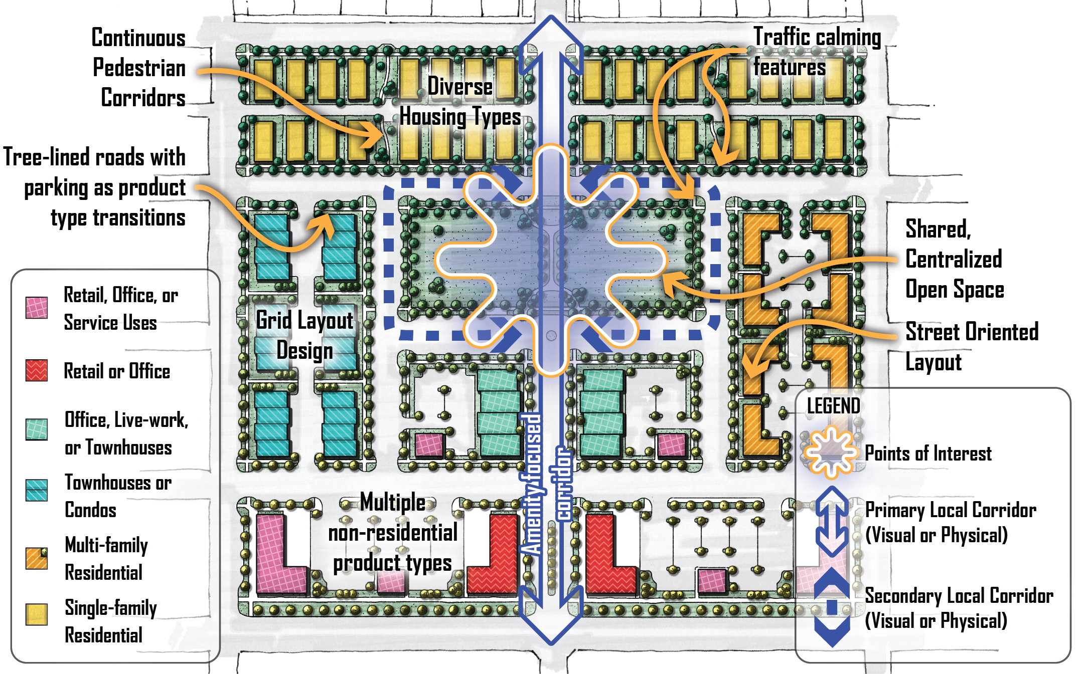
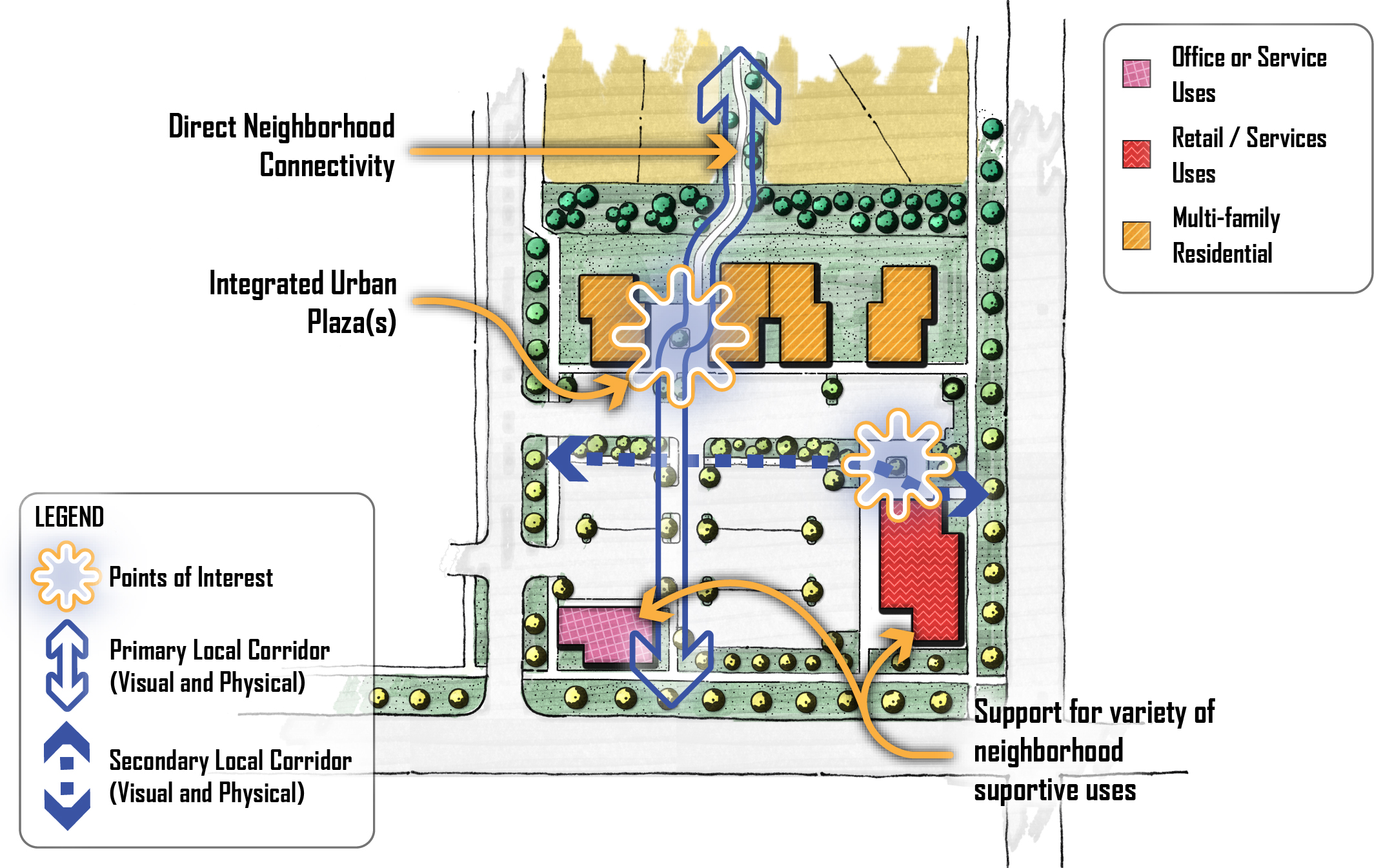
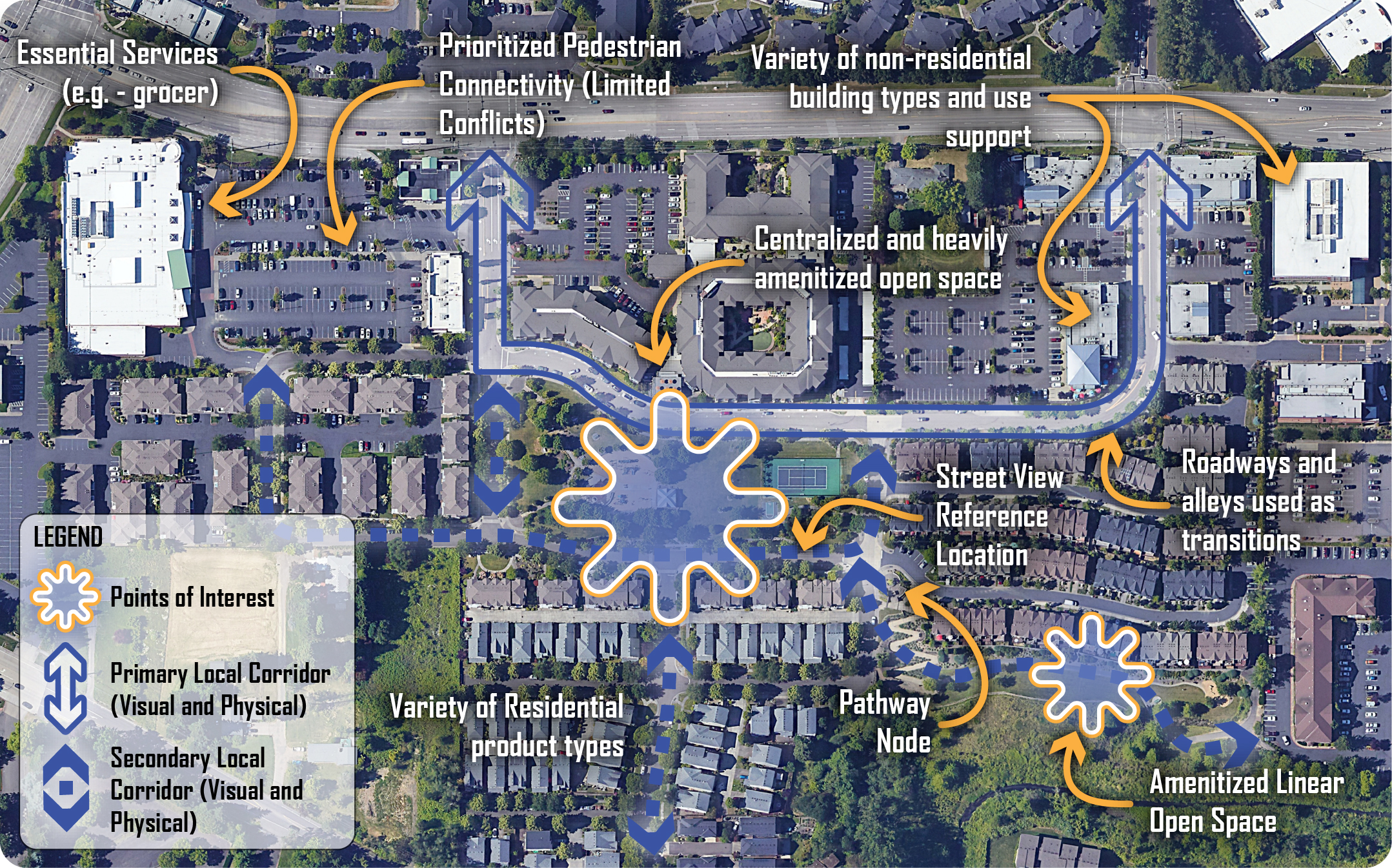
The following images are colorized versions of the mixed use concept included in the Land Use section of the Comprehensive Plan. These colorized concepts include additional annotation styles that more closely align with aerial examples of real mixed use projects in Appendix F, Section B. These are intended to better identify different building types, and to correlate design features with actual mixed use projects.
The following definitions may be helpful when reviewing these concepts:
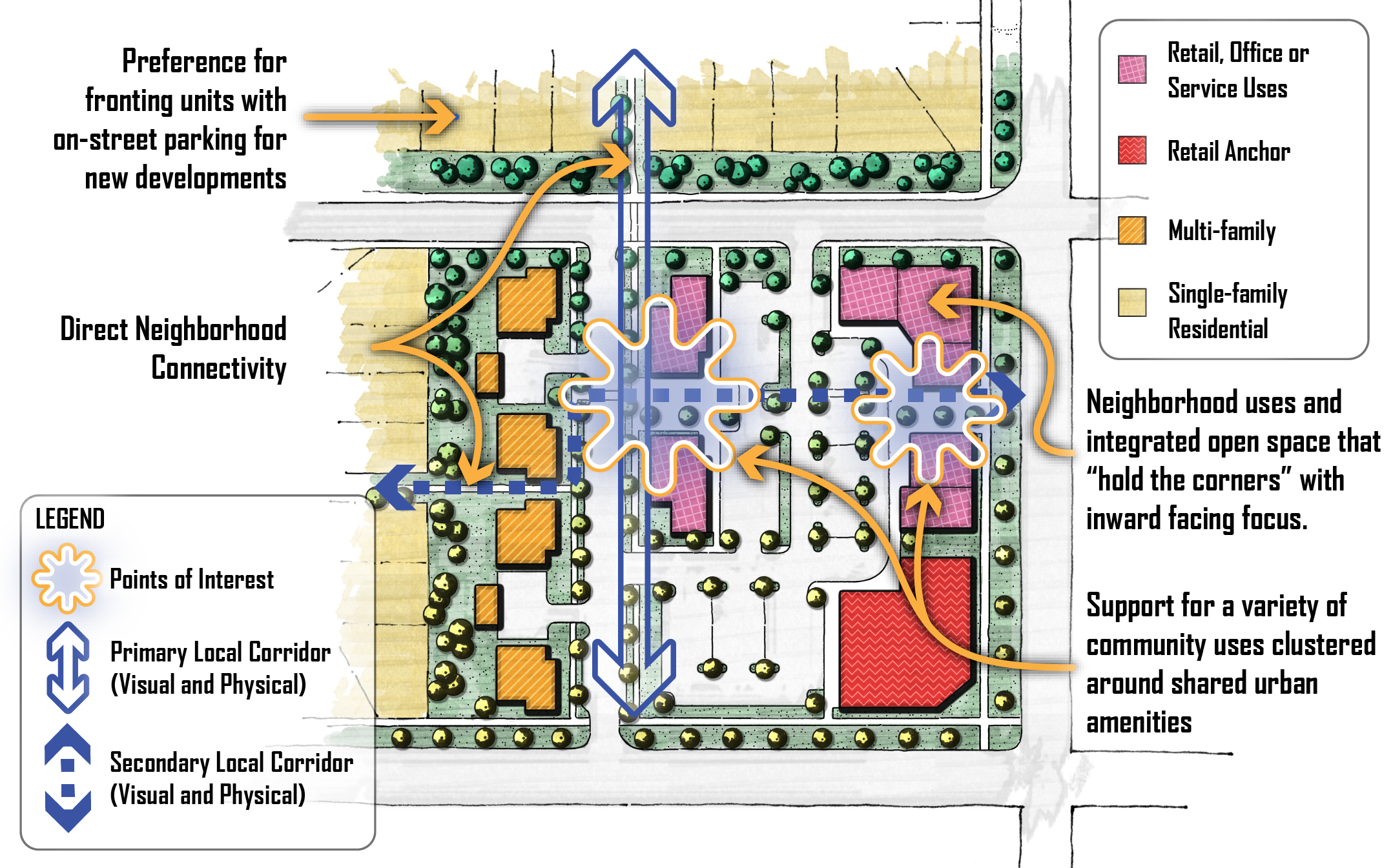
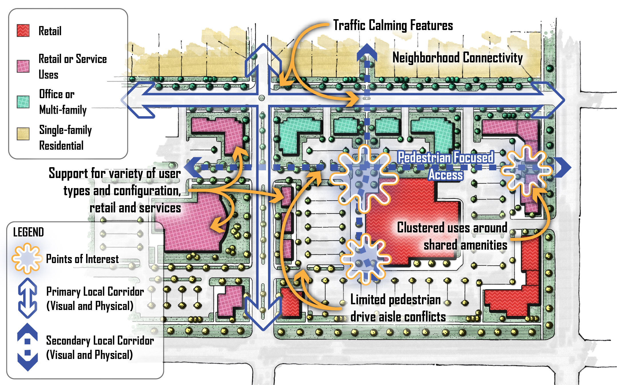
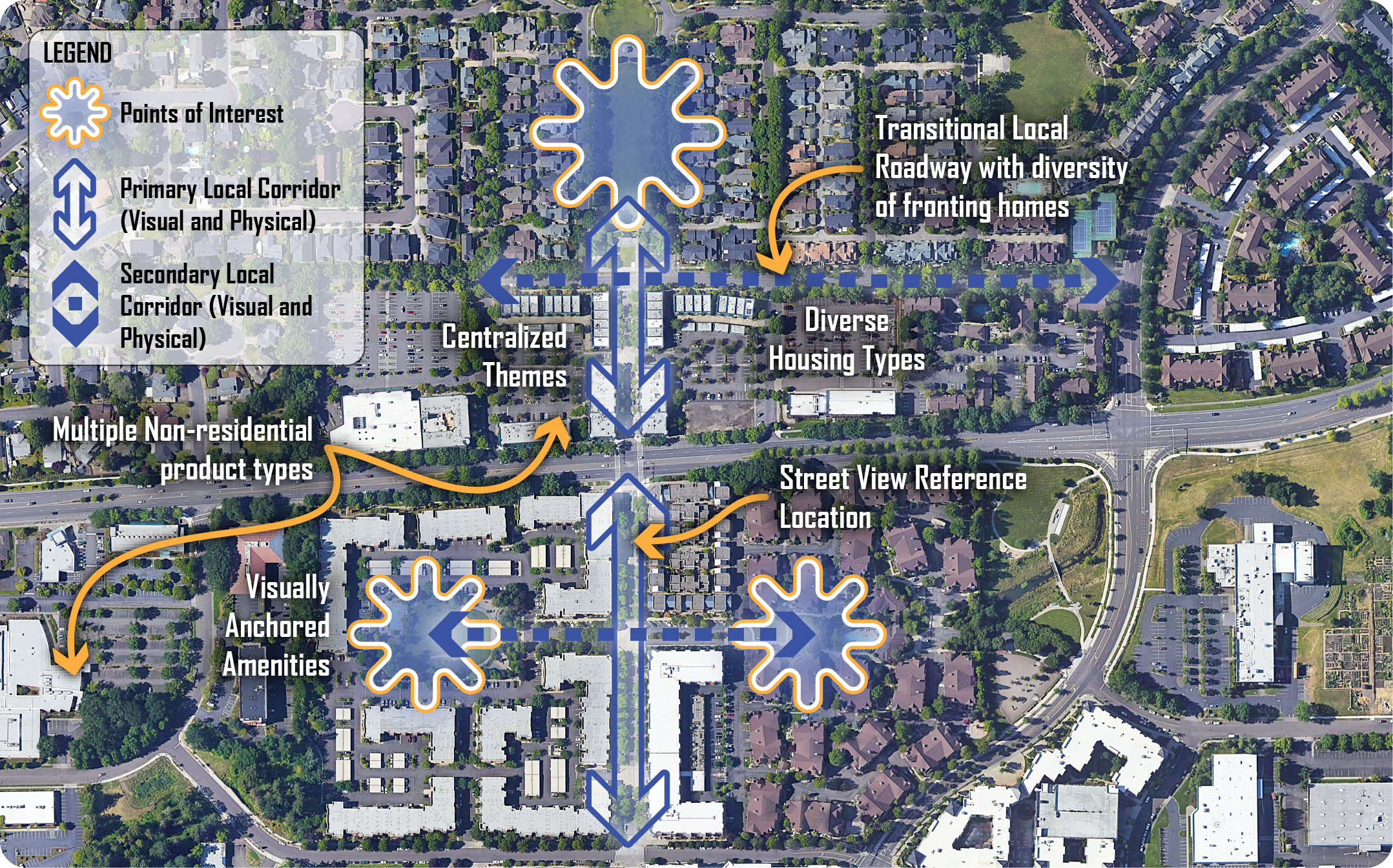
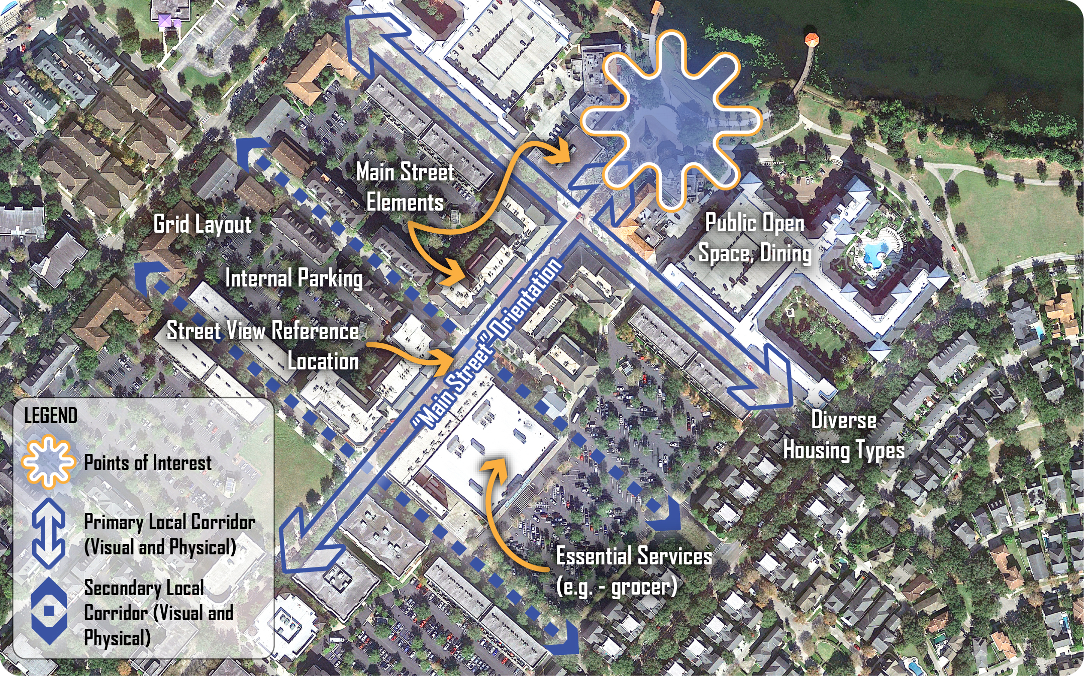
- Points of Interest: Generally intended as public spaces such as an urban plaza or small park, but may also be a historical site, a building with architectural interest, a landmark with significance, or some other unique visual point of interest.
- Primary Local Corridor (Visual and Physical): The main transportation and/or visual corridor linking the area; size is relative. When depicting a roadway, the cross-section is context sensitive to the adjacent land use. This could be considered the main thoroughfare or feature.
- Secondary Local Corridor (Visual and Physical): Secondary transportation and/or visual corridors linking the area; size is relative. When depicting a roadway, the cross-section context sensitive. This is often shown as pedestrian connections but may also be secondary vehicular to highlight pedestrian prioritized areas.
FA1. Mixed Use Concept Color Diagram with Markup
FA2. Mixed Use Neighborhood Concept Color Diagram with Markup
FA3. Mixed Use Community Concept Color Diagram with Markup
FA4. Mixed Use Regional Concept Color Diagram with Markup
B. Mixed Use Project Examples
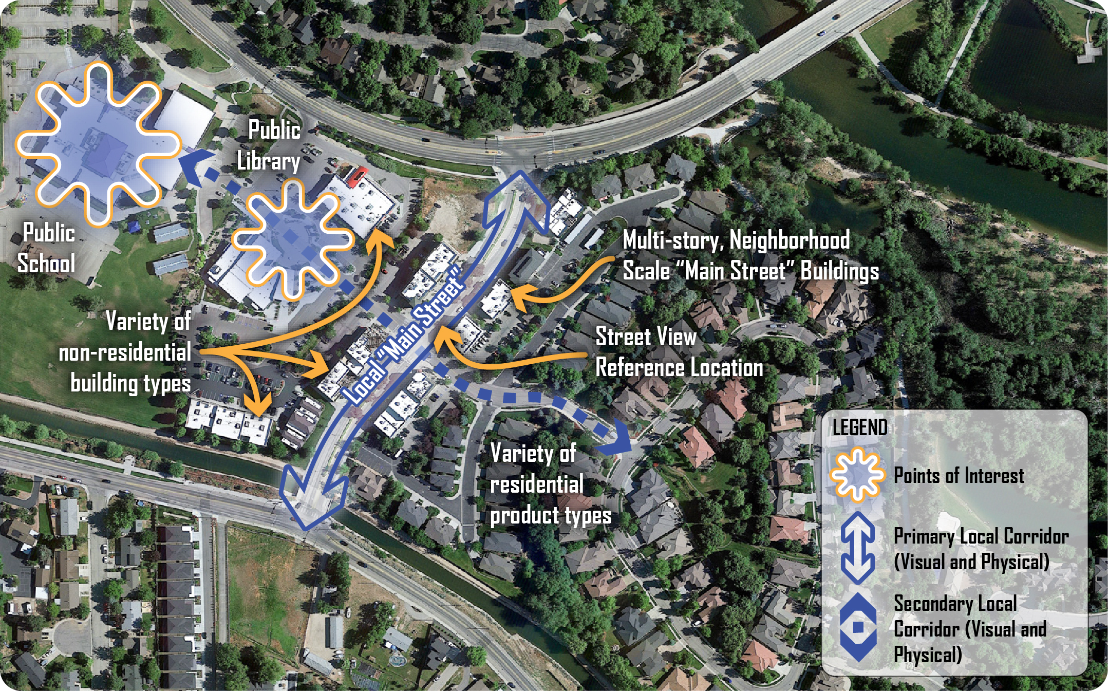
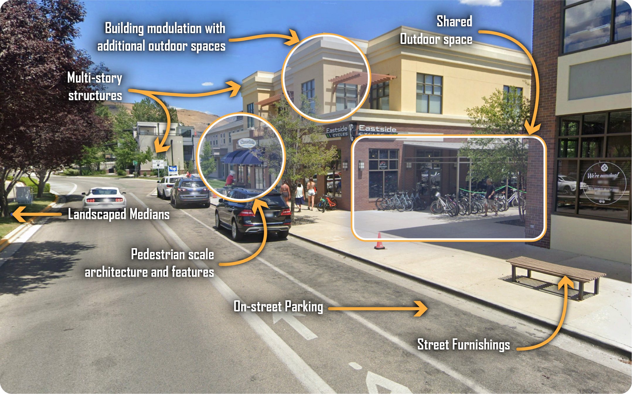
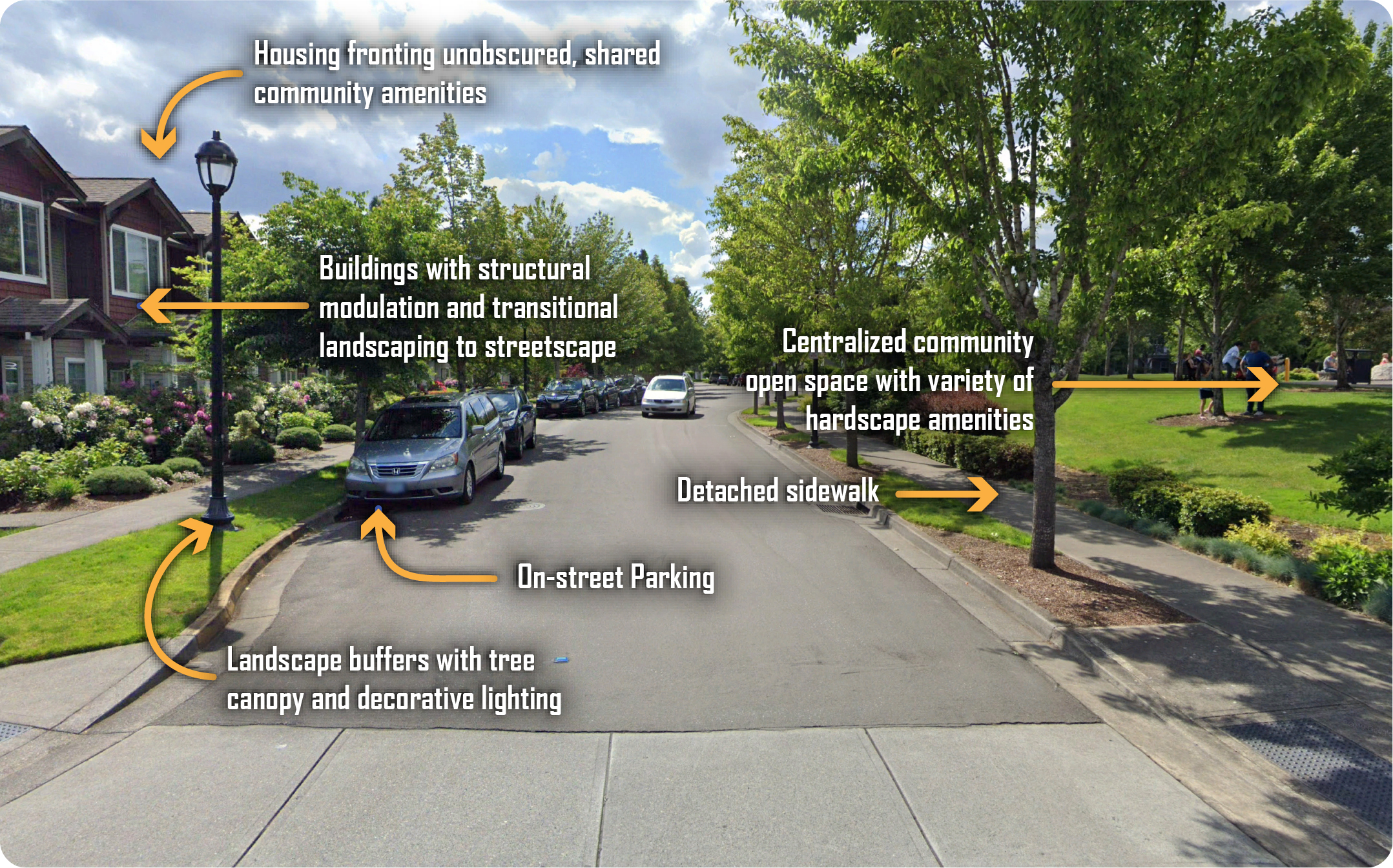
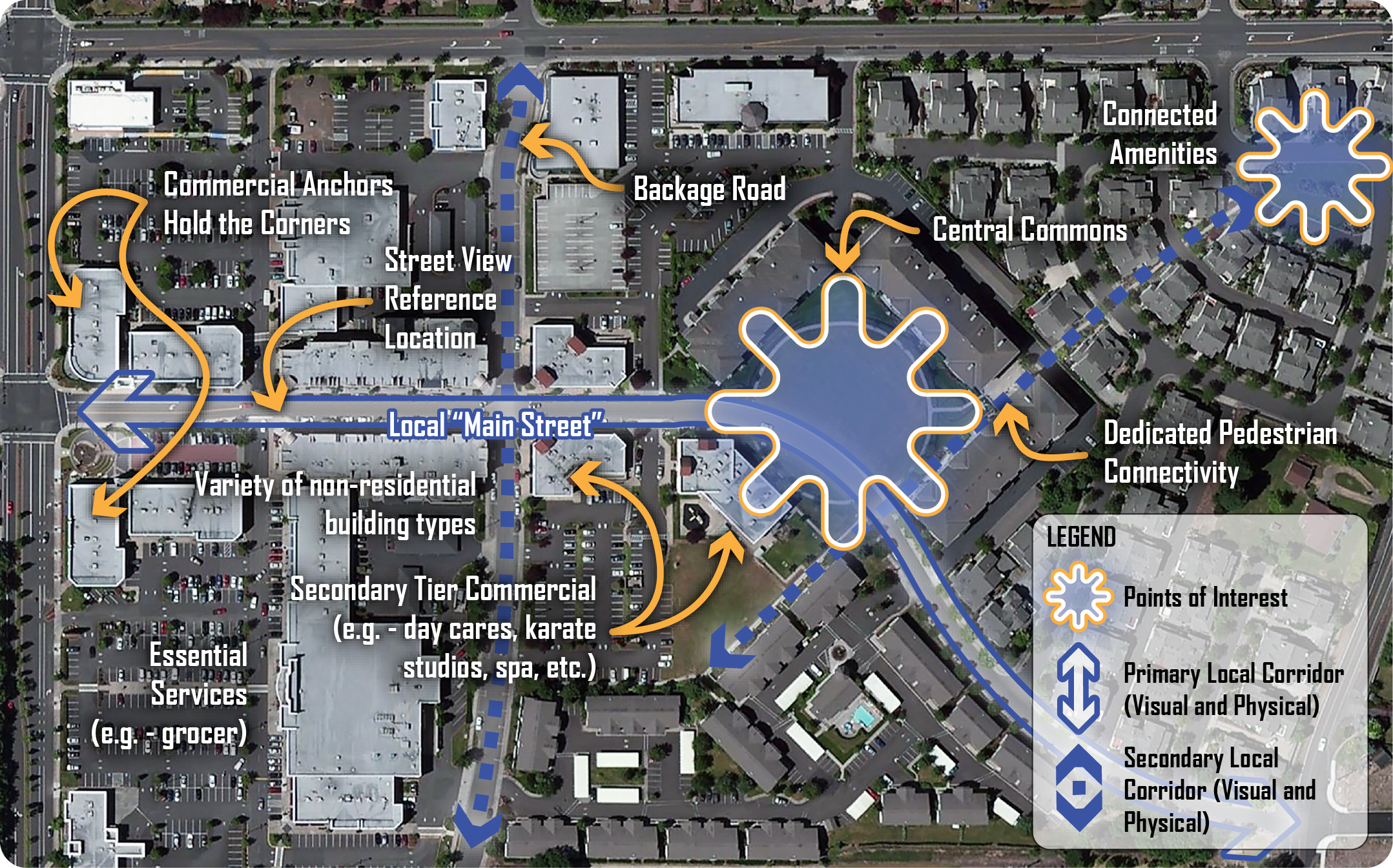
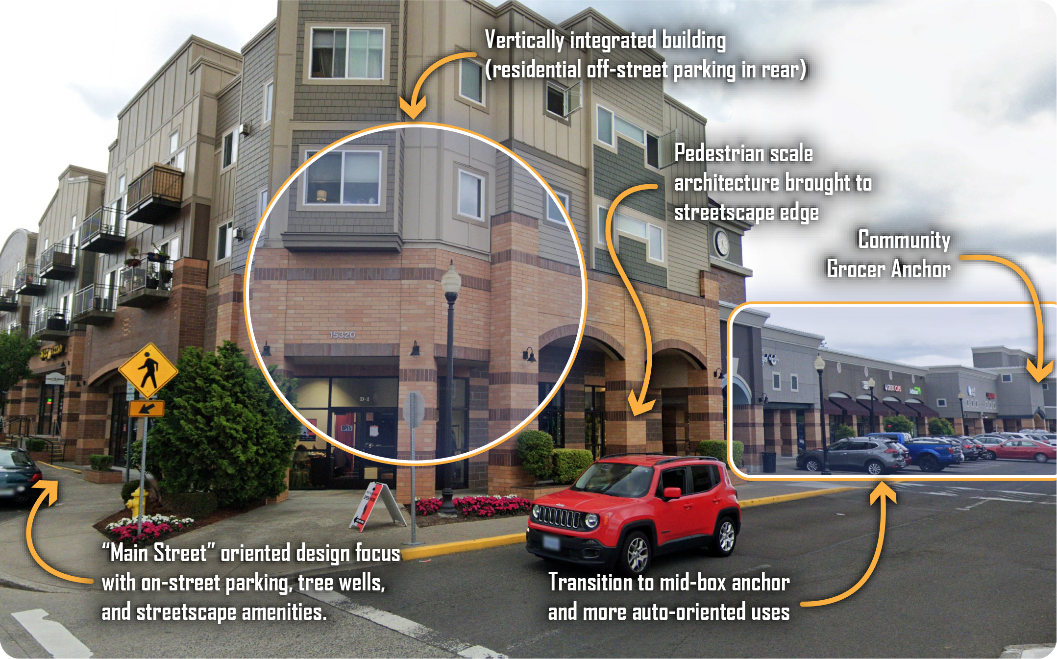
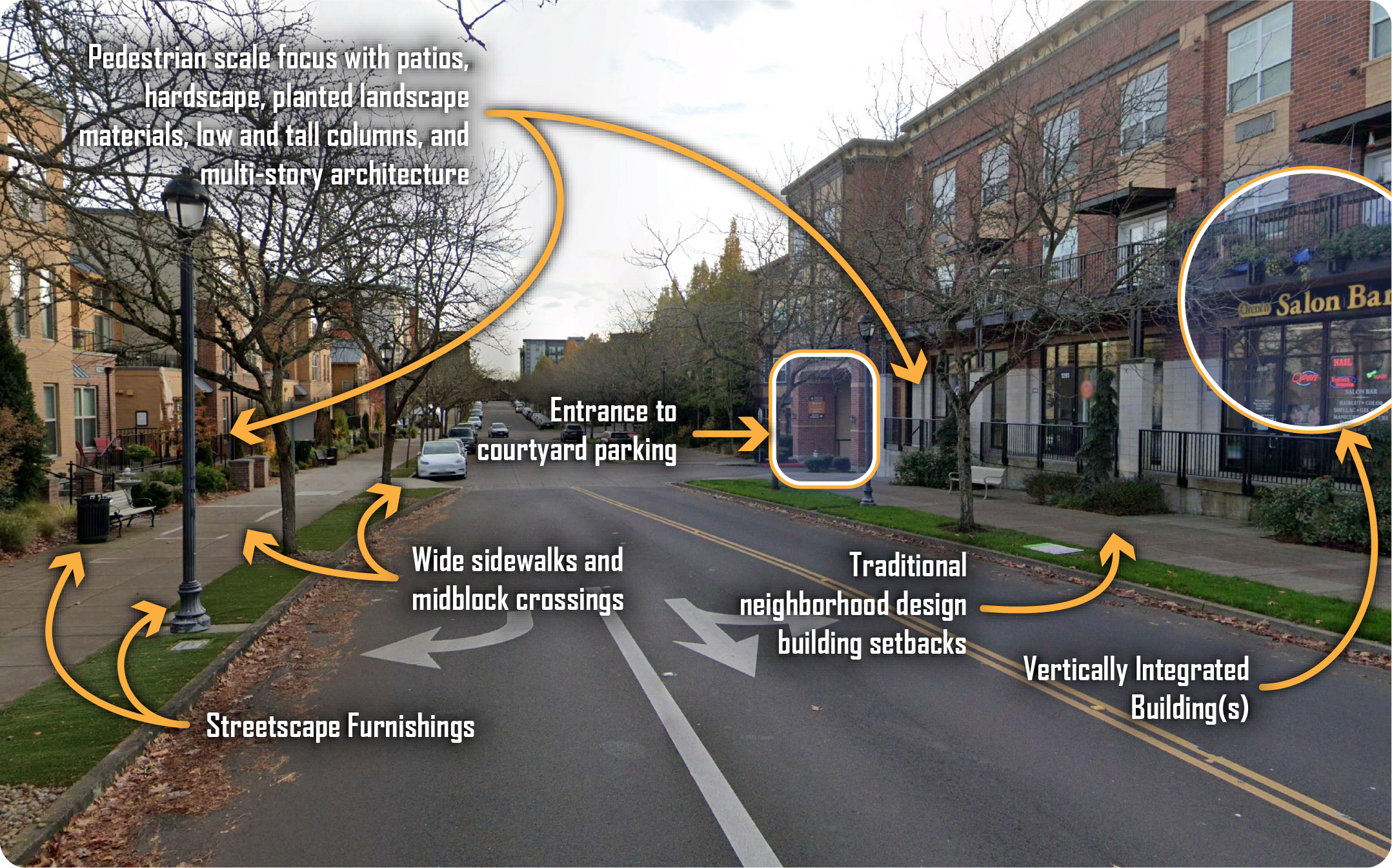
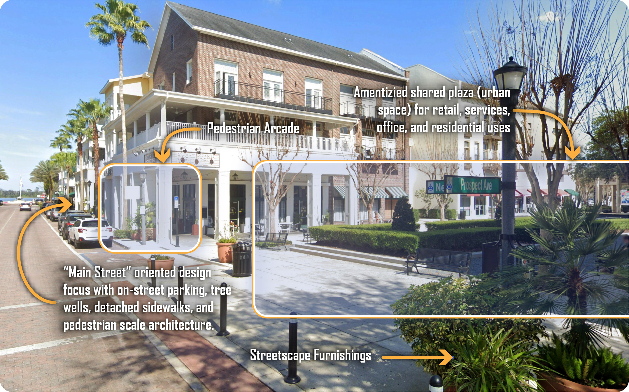
Images on the following pages include aerial and street view photo examples of mixed use projects. These images are intended to supplement conceptual graphics included in Appendix F, Section A, and the general text of the Comprehensive Plan. Reference points on aerial images indicate the location of any companion street view examples.
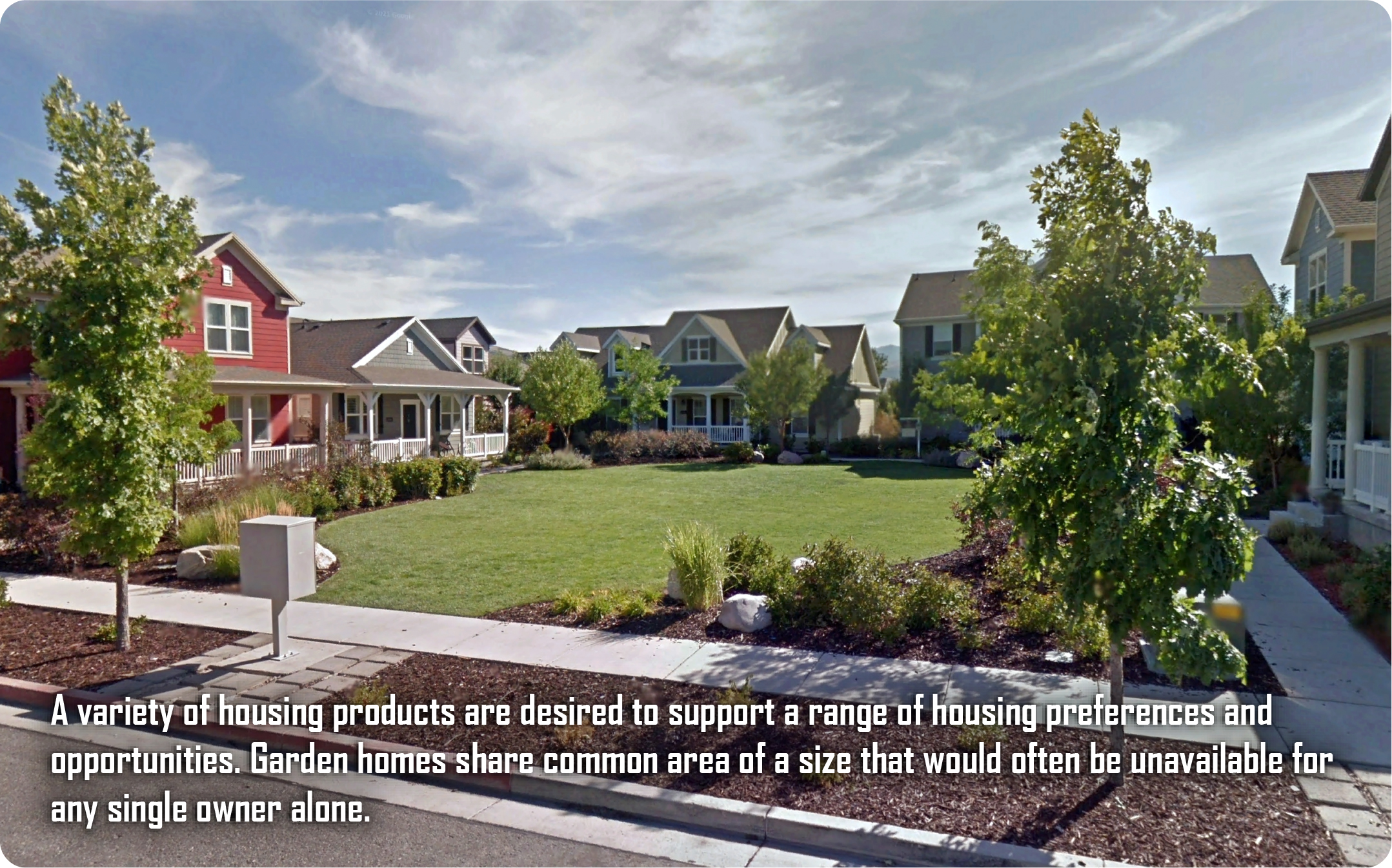
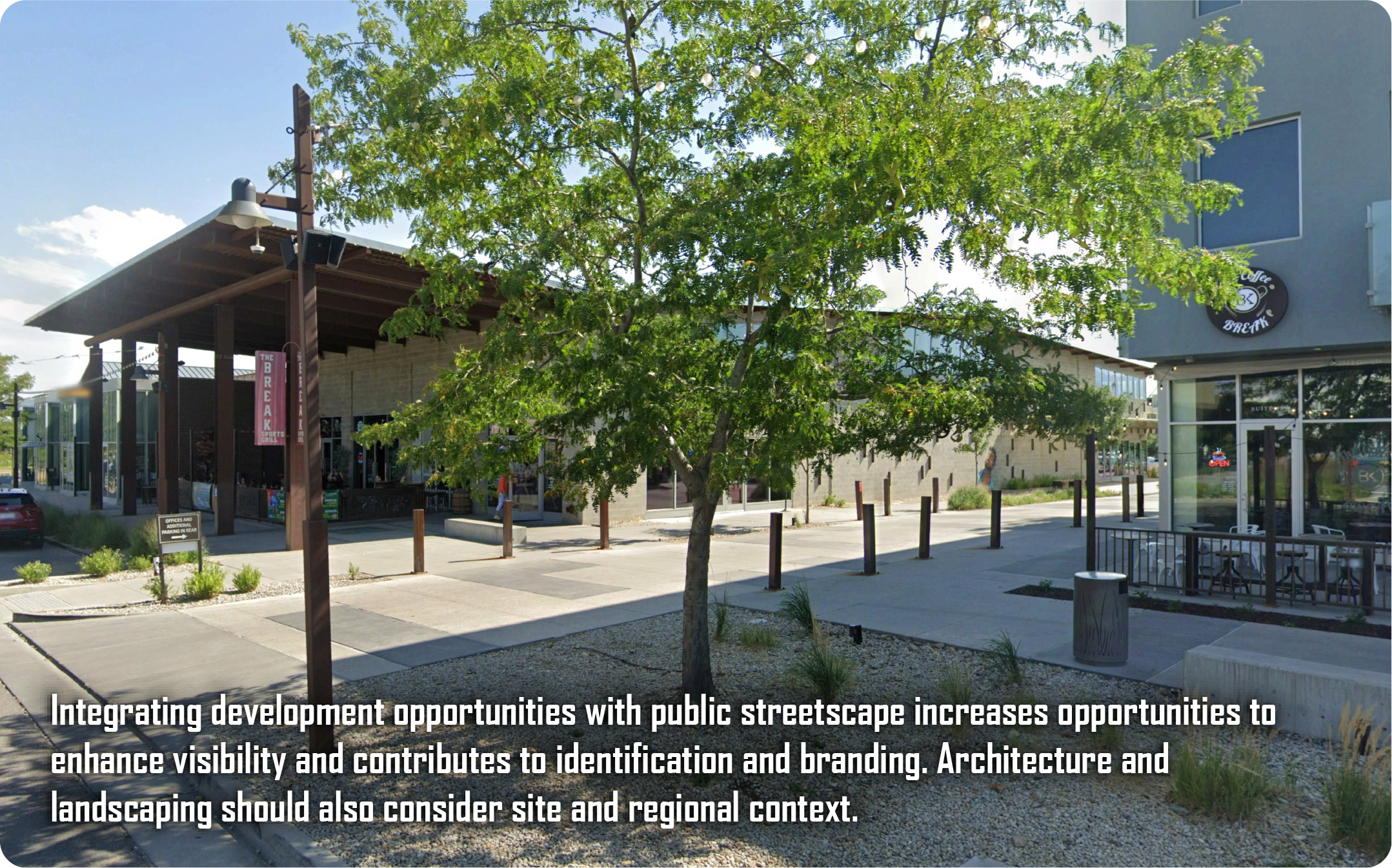
These examples are all real-life, developed, unique projects with locations and land development policies that vary across the Country.
FB1. Bown Crossing Mixed Use Area
FB2. Magnolia Mixed Use Area
FB3. Bethany Mixed Use Area
FB4. Orenco Mixed Use Area
FB5. Baldwin Park Mixed Use Area
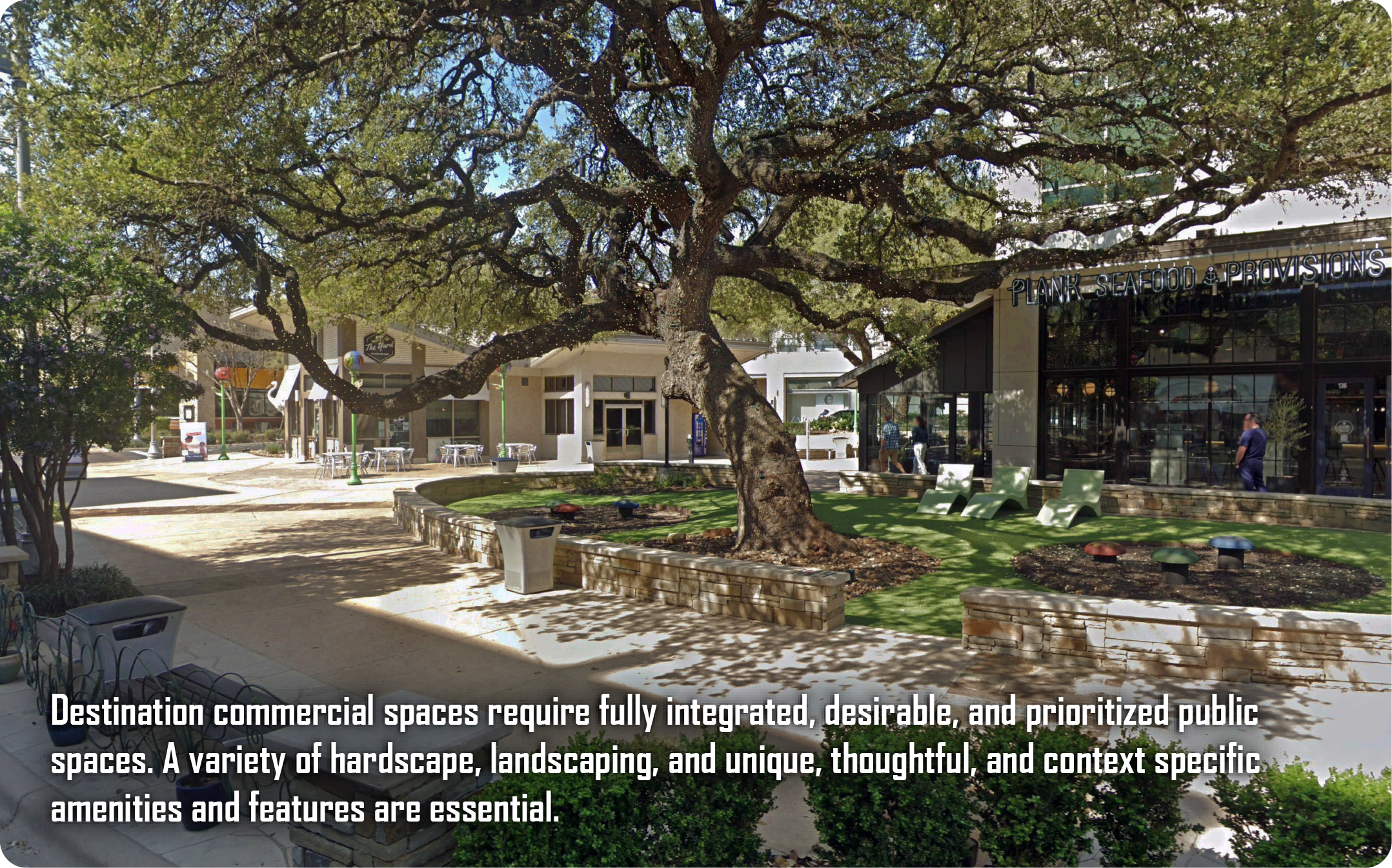
C. Public Spaces, Node, and Link Examples
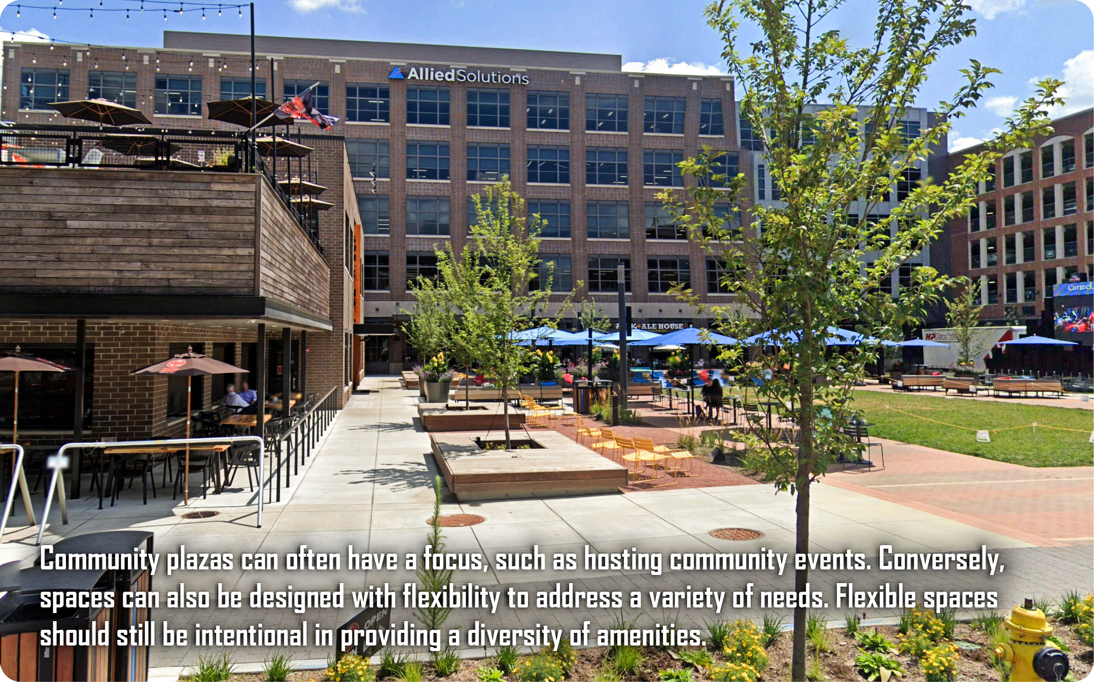
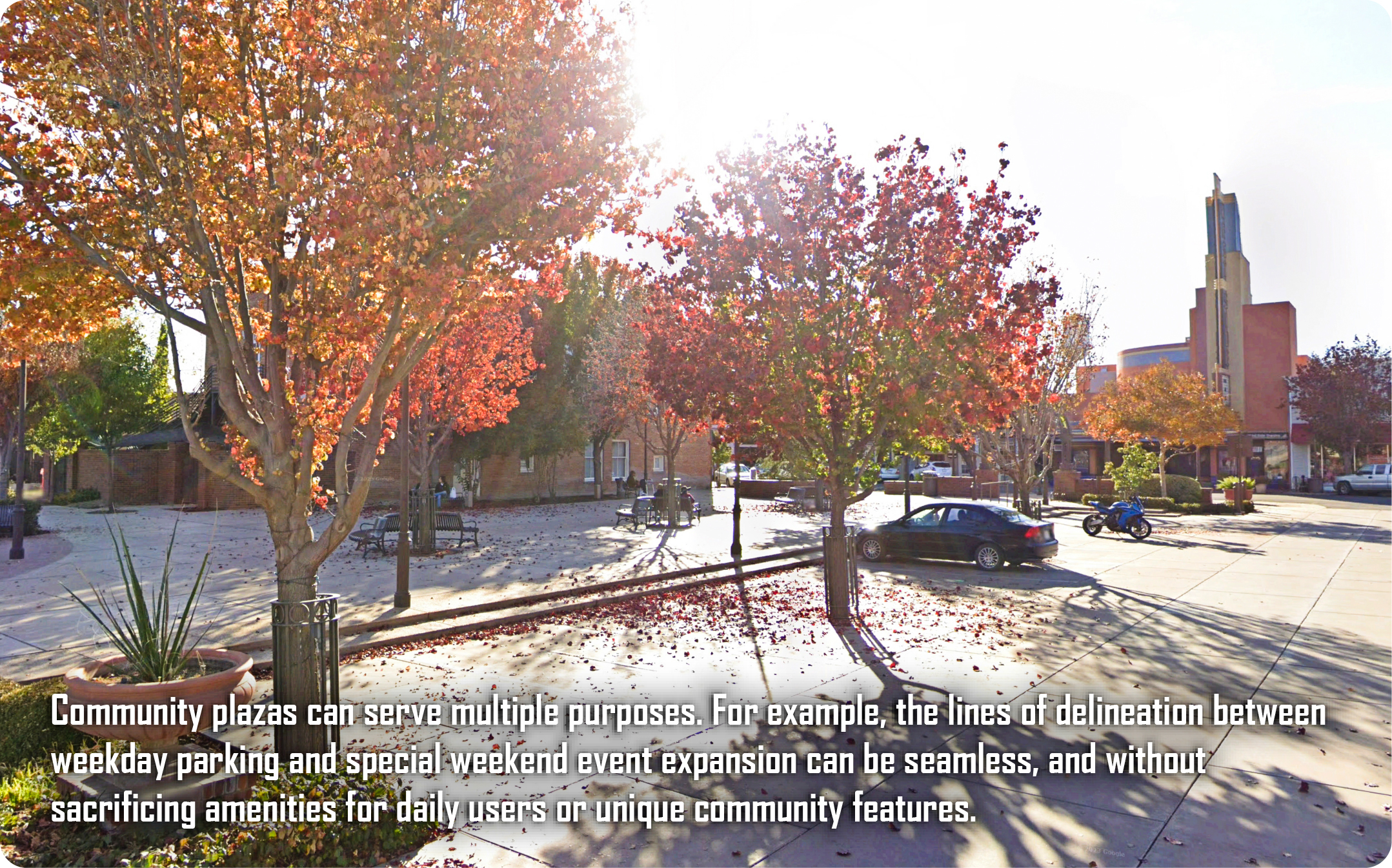
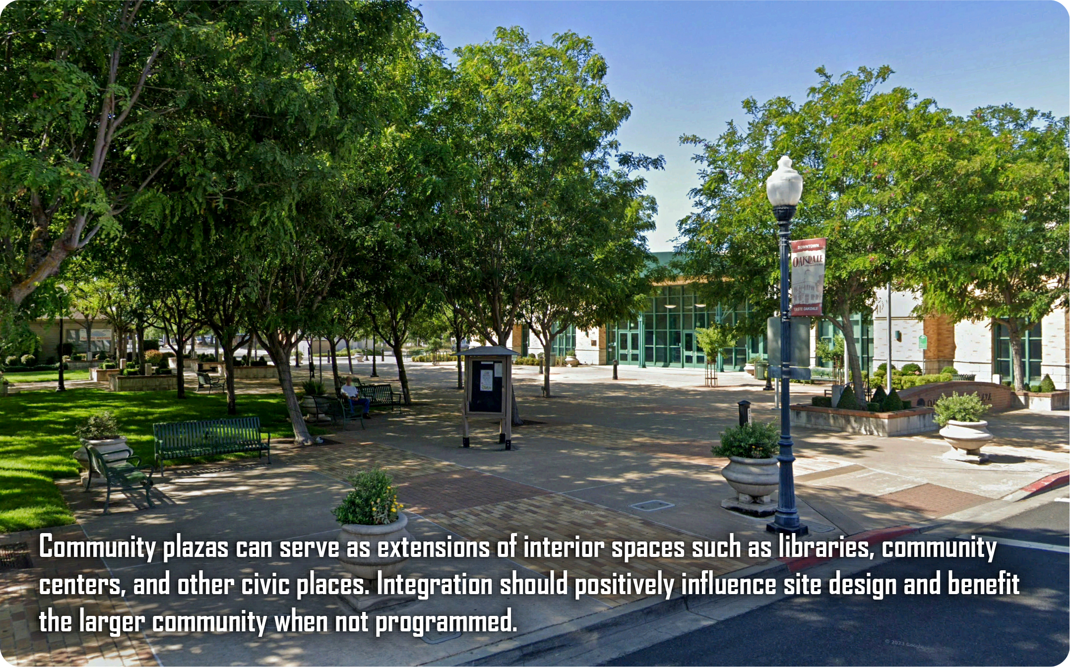
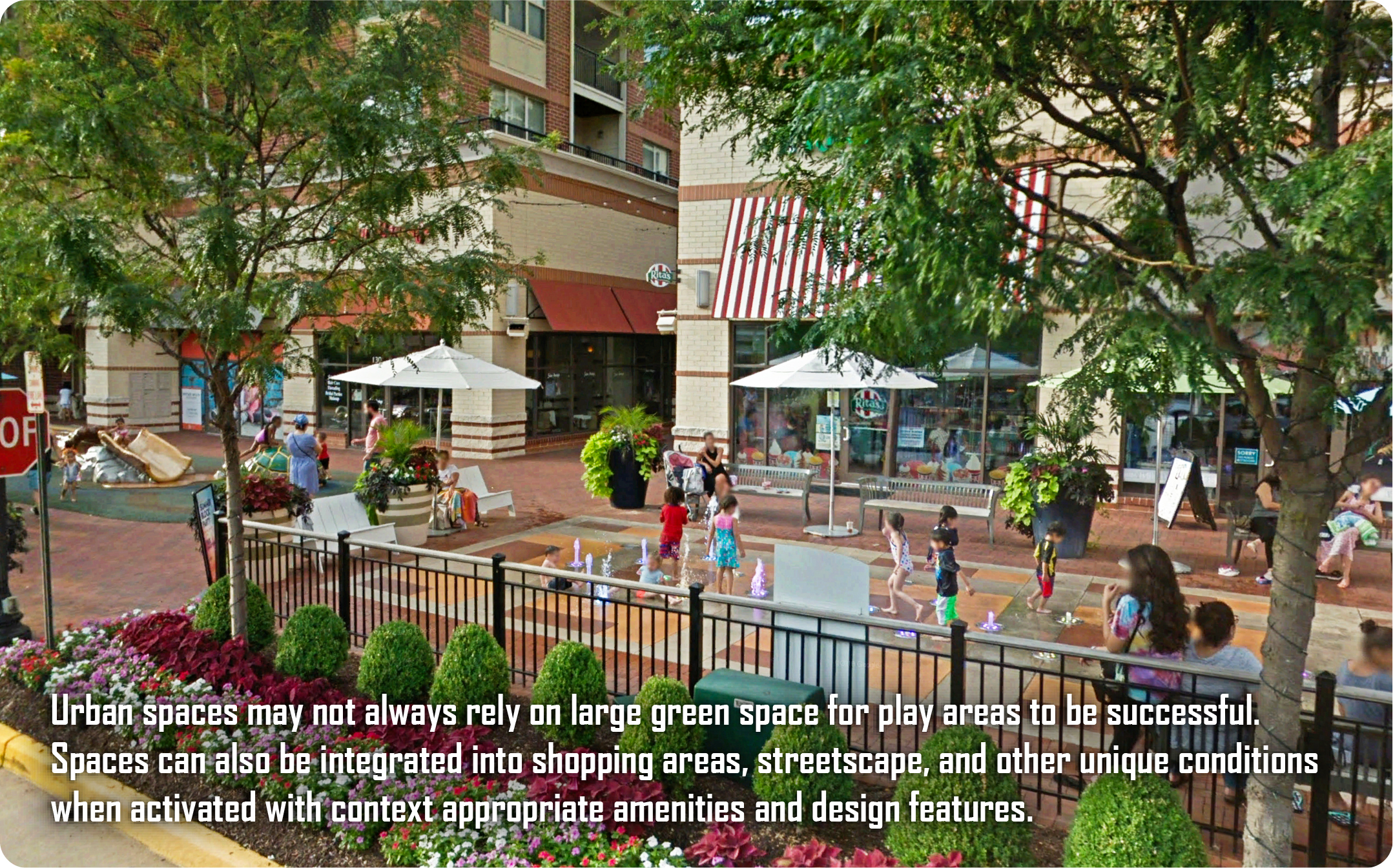
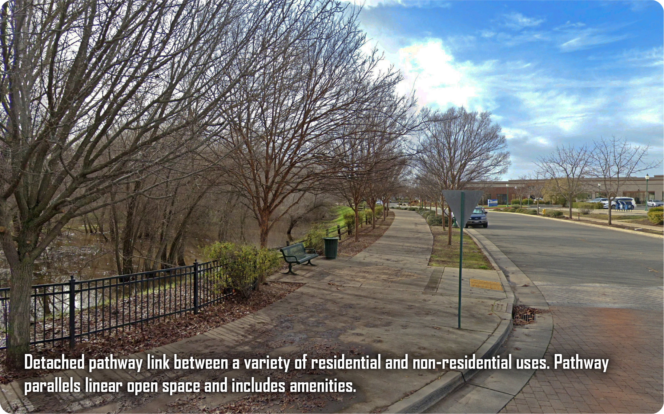
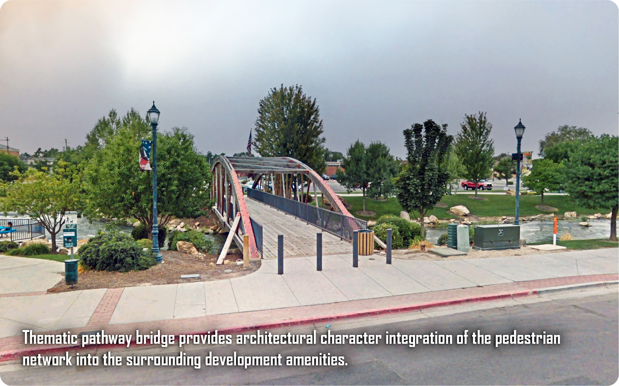
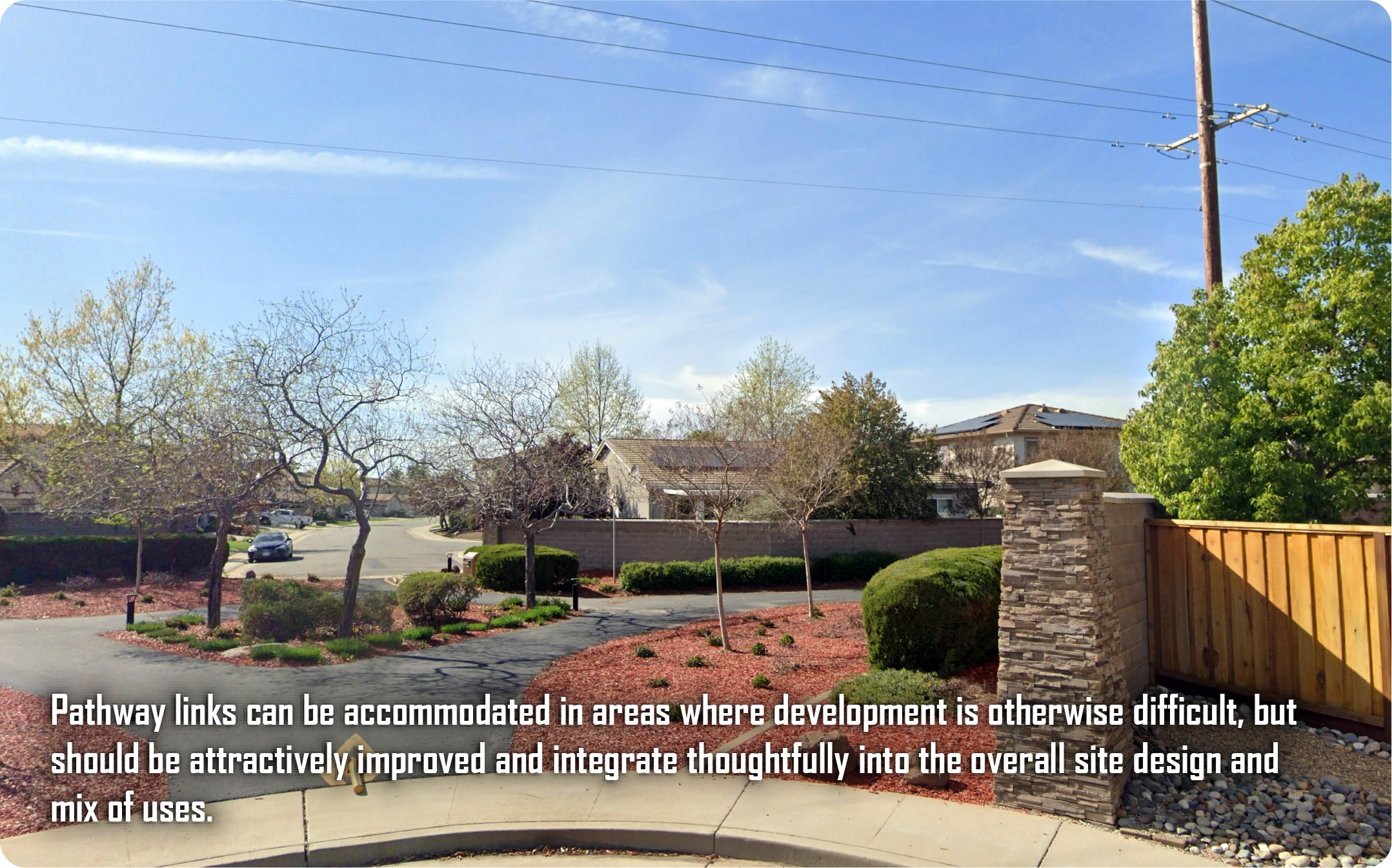
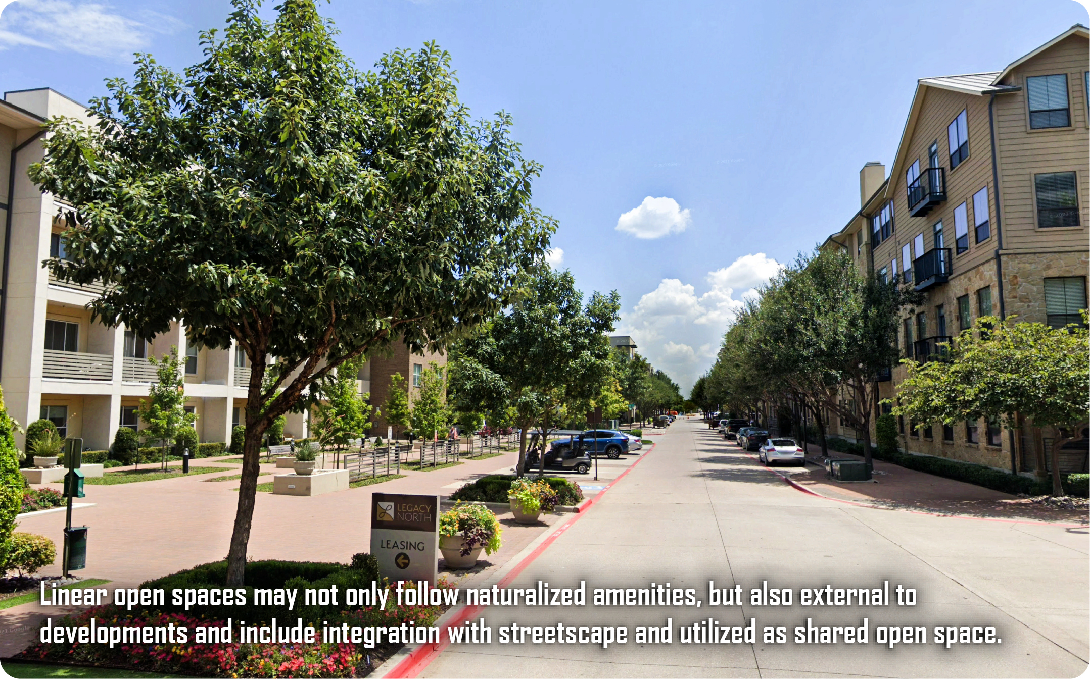
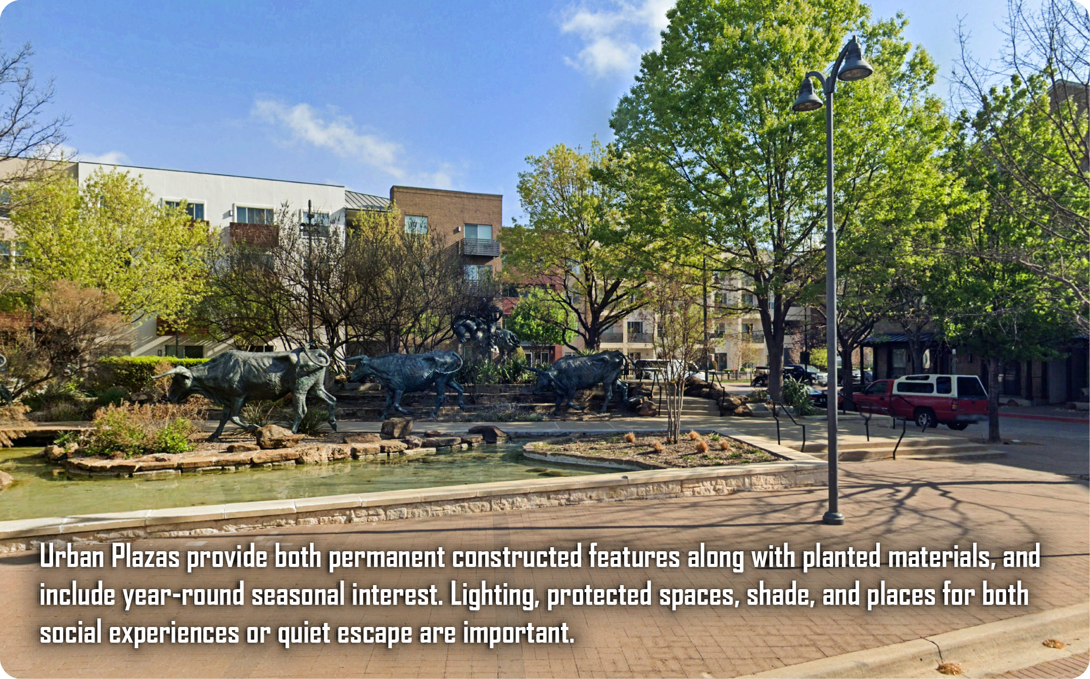
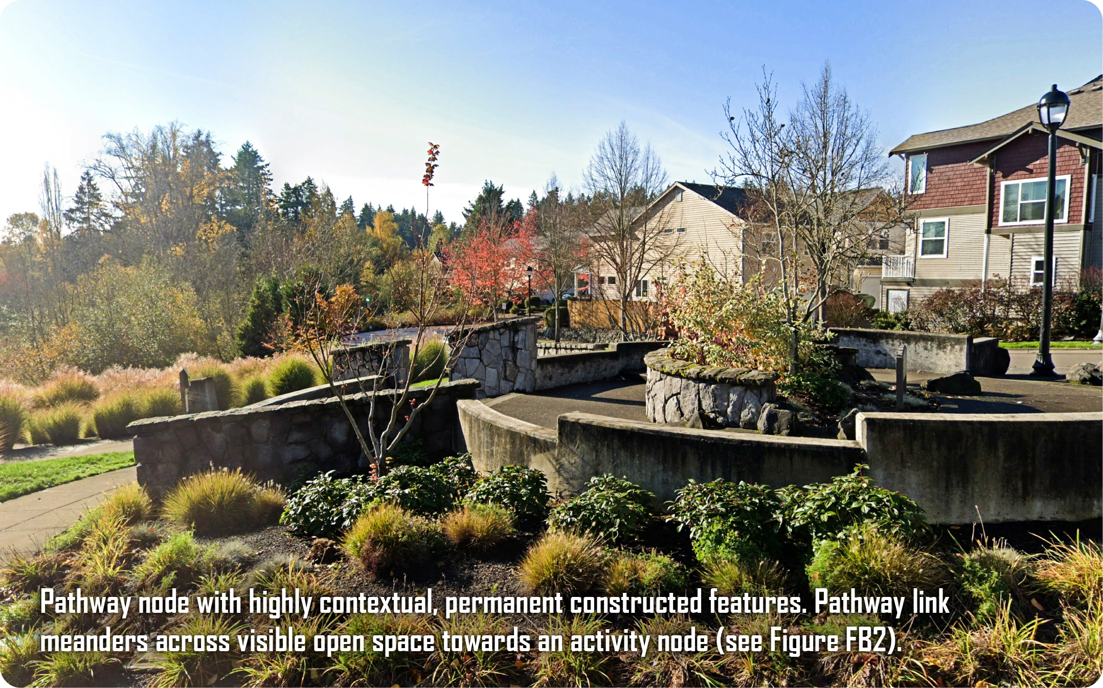
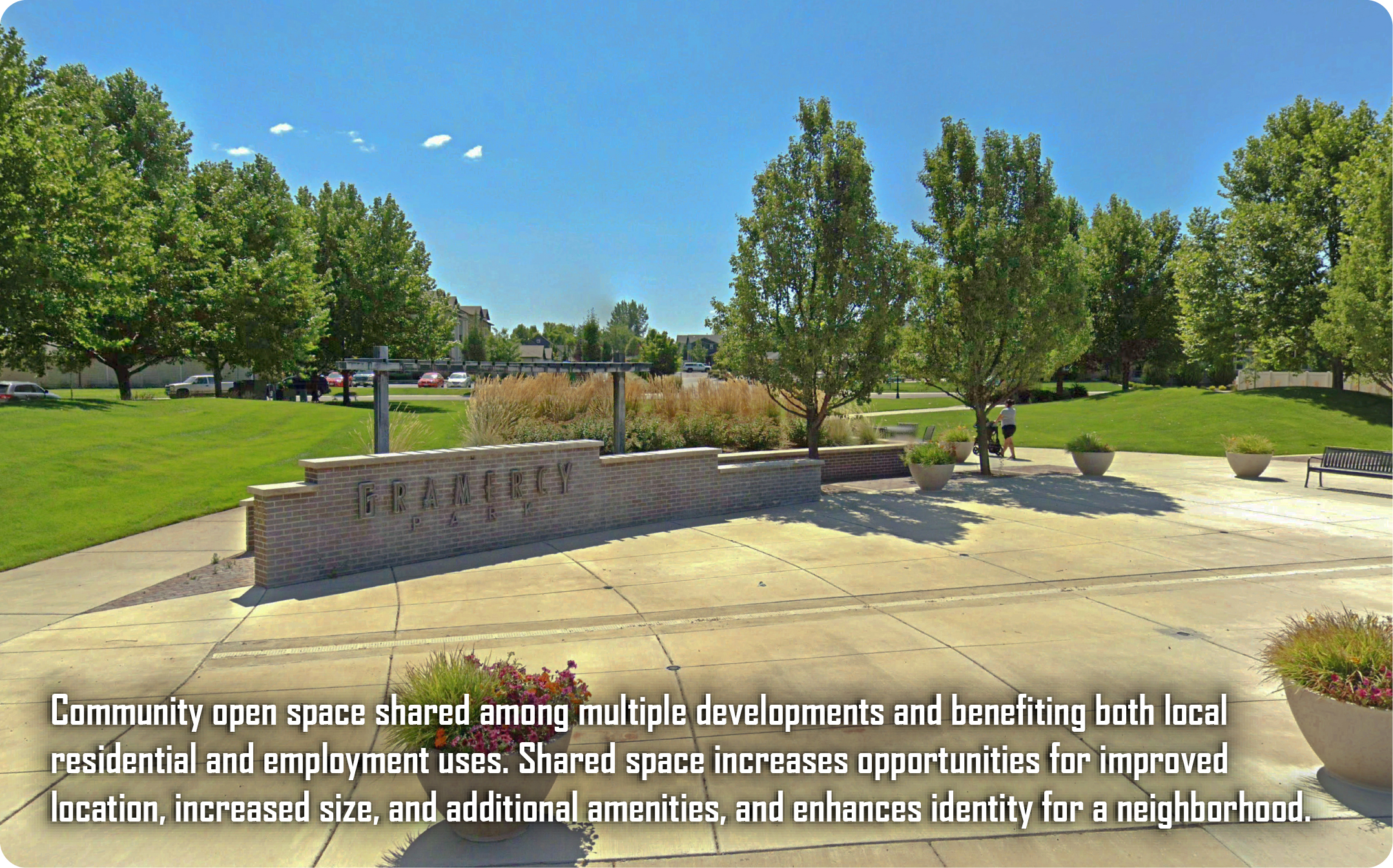
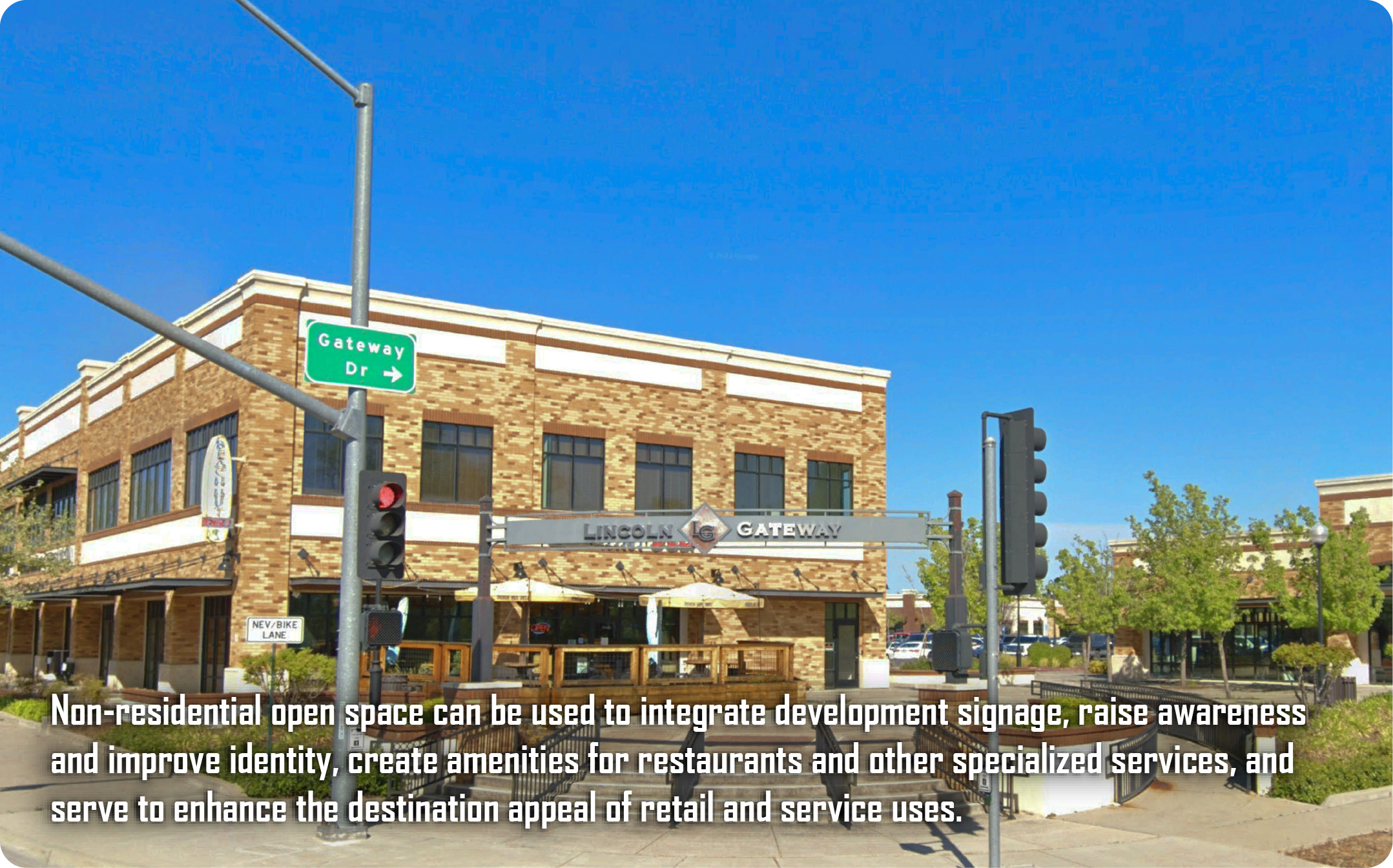
The following images are examples of pathways and public spaces that may be appropriate in mixed use areas. These are organized by interconnected nodes and links. Nodes are often places of respite or of focal activity, and activated with amenities that usually include constructed hardscape or play elements. Links are features such as pathways or linear spaces connecting nodes, usually visibly, and in a meaningful and interrelated context.
These examples are all developed in unique projects with locations, environments, and land development policies that vary across the County. However, the design nodes and links depicted may be replicated in similar settings within Meridian.
D. Other Examples
The following examples are a variety of public space examples with unique features, such as having special functionality or in serving alternative transportation.